The Great World Maps
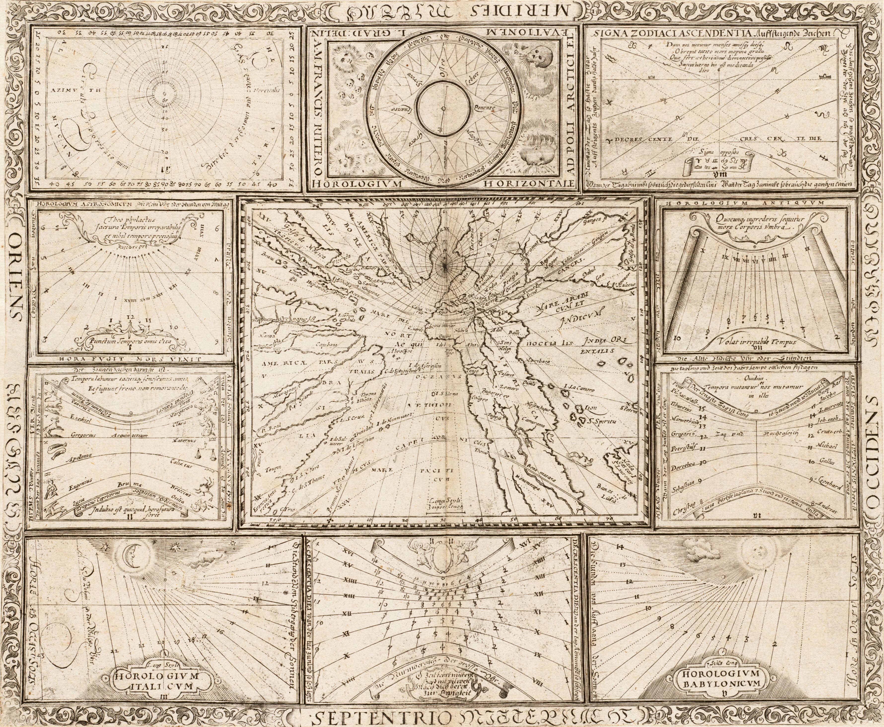
Ritter's World of the Sun
A world map as a clock, with skulls for the south winds.
- Map
- World map, from Speculum Solis
- Mapmaker
- Franz Ritter
- Date
- 1607
- Held by
- Norman B. Leventhal Map & Education Center, Boston Public Library · via Digital Commonwealth
Format
The full-resolution scan, color-managed to the source — yours to print, study, and explore.
Size
$29.00
The story
Franz Ritter, a German mathematician, made this sheet for his Speculum Solis, the mirror of the sun, published at Nuremberg in 1607 with text in Latin and German. The world is projected from the North Pole at the centre, and ten diagrams around it show different ways of measuring and recording time. At the top centre is a wind diagram: the four principal winds circle a compass, with north at the south, and the destructive winds of the south are drawn as skulls, for the harm they were believed to do. A map, a sundial and a warning, on one page.
About this reproduction
- A faithful reproduction of a public-domain map held by Norman B. Leventhal Map & Education Center, Boston Public Library · via Digital Commonwealth — the work is centuries out of copyright.
- Printed to order on 200gsm EMA matte art paper or 400gsm canvas; framed pieces sit behind acrylic.
- Color-managed to the source scan; we correct nothing and invent nothing.
- Ships in 5–10 business days, rolled in a heavy-wall tube (framed and linen-backed pieces ship flat-packed).
- If it arrives less than perfect, we reprint or refund — your choice.
Why our maps cost more than a poster: we print from the highest-resolution scans in existence, at sizes where the engraving itself becomes visible — the sea monsters, the tiny place-names, the burin lines — on matte paper that holds every line without glare.