The Great World Maps
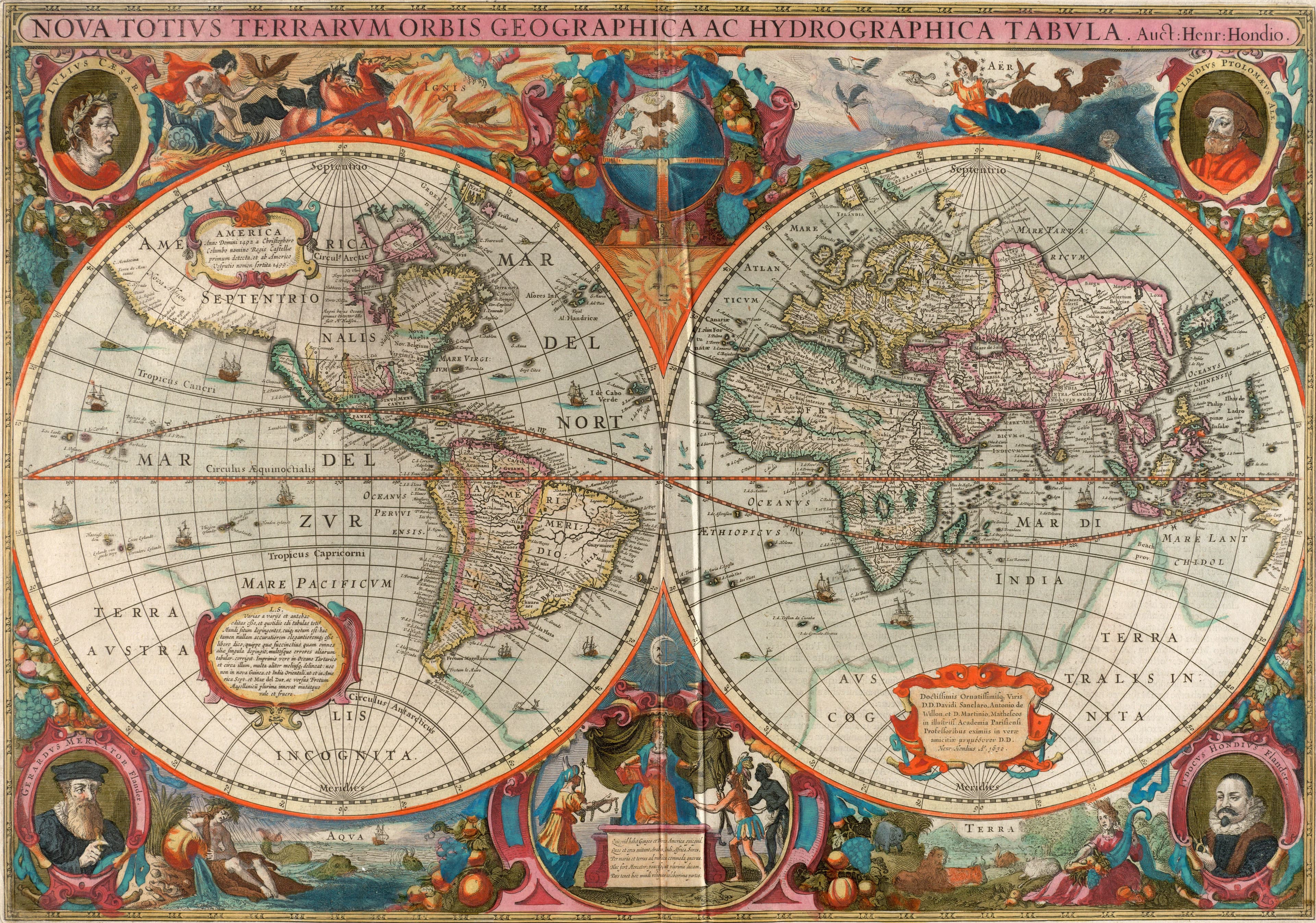
Hondius's World in Two Hemispheres
Both faces of the globe, framed by four mapmakers.
- Map
- Nova totius terrarum orbis geographica ac hydrographica tabula
- Mapmaker
- Henricus Hondius
- Date
- 1630, printed 1638
- Held by
- Norman B. Leventhal Map & Education Center, Boston Public Library · via Digital Commonwealth
Format
The full-resolution scan, color-managed to the source — yours to print, study, and explore.
Size
$29.00
The story
Henricus Hondius drew this world in 1630, while he and Jan Jansson were reviving the atlas Gerard Mercator had begun in 1595 and Henricus's father Jodocus had carried on for thirty-five years. He set the Earth in two hemispheres, so a reader sees both faces of a globe at once. Look at the border: portraits of Julius Caesar, Ptolemy, Mercator and Jodocus Hondius hold the corners, and vignettes of fire, air, water and land run above and below. The plate stayed in the Mercator atlases from 1633 to 1658. A family business, framed by its own ancestors.
About this reproduction
- A faithful reproduction of a public-domain map held by Norman B. Leventhal Map & Education Center, Boston Public Library · via Digital Commonwealth — the work is centuries out of copyright.
- Printed to order on 200gsm EMA matte art paper or 400gsm canvas; framed pieces sit behind acrylic.
- Color-managed to the source scan; we correct nothing and invent nothing.
- Ships in 5–10 business days, rolled in a heavy-wall tube (framed and linen-backed pieces ship flat-packed).
- If it arrives less than perfect, we reprint or refund — your choice.
Why our maps cost more than a poster: we print from the highest-resolution scans in existence, at sizes where the engraving itself becomes visible — the sea monsters, the tiny place-names, the burin lines — on matte paper that holds every line without glare.