The Great World Maps
Hase's World for the Schoolroom
The two hemispheres, and six more ways to see a globe.
- Map
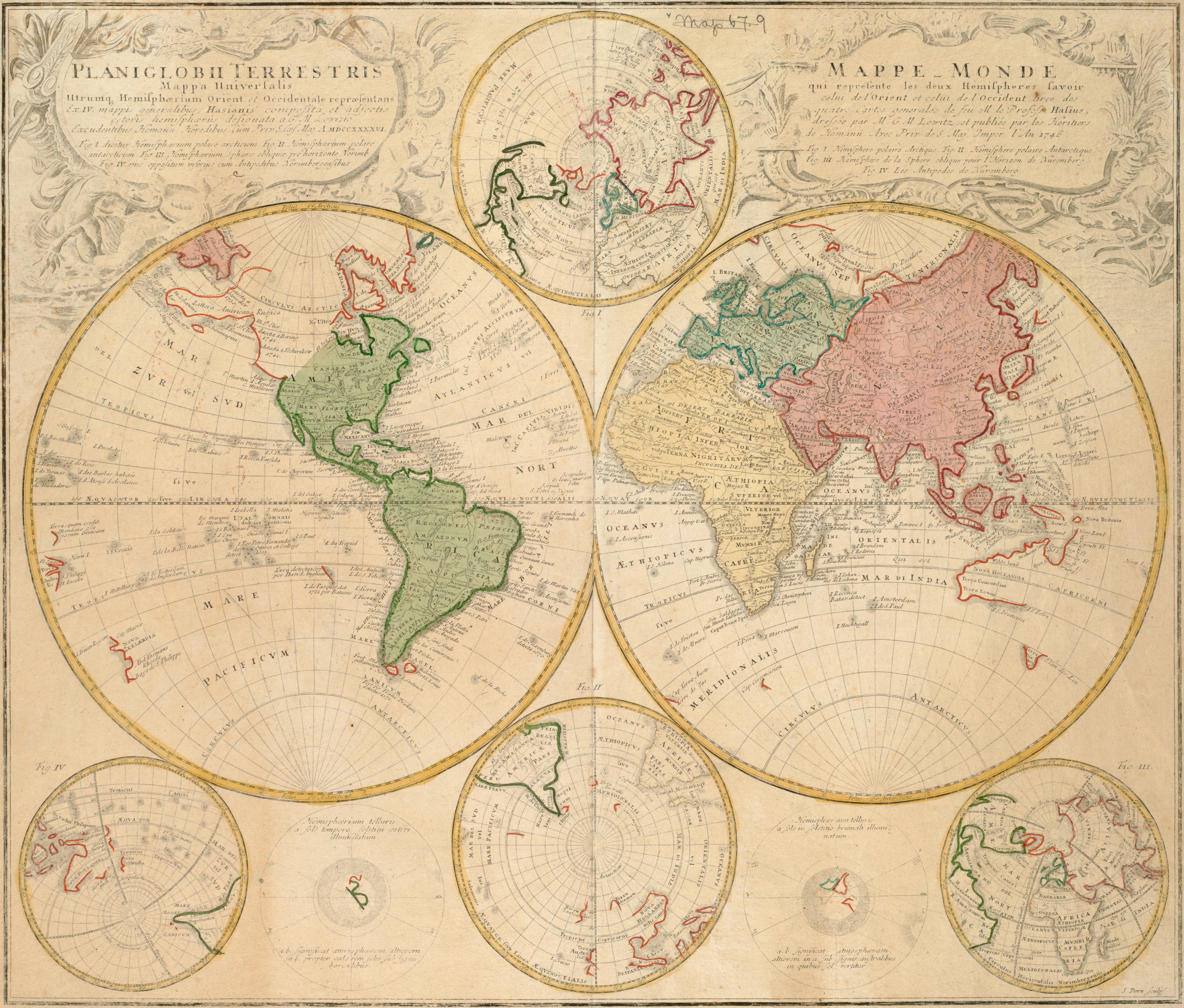
- Planiglobii terrestris mappa universalis utrumque hemisphaerium orientale et occidentale repraesentans ex IV mappis generalibus
- Mapmaker
- Johann Matthias Hase
- Date
- 1746
- Held by
- Norman B. Leventhal Map & Education Center, Boston Public Library · via Digital Commonwealth
Format
The full-resolution scan, color-managed to the source — yours to print, study, and explore.
Size
$29.00
The story
Johann Matthias Hase drew the eastern and western hemispheres from four general maps, and the Homann heirs of Nuremberg printed the sheet in their Schul-atlas, a school atlas of twenty general and special maps, in 1746. Around the two great circles sit six smaller maps showing the globe from different points of view. That is the lesson of the sheet: there is no single right way to flatten a sphere, so the student is shown several and left to compare them. Hase died in 1742, and his world went on teaching in the schoolroom after him.
About this reproduction
- A faithful reproduction of a public-domain map held by Norman B. Leventhal Map & Education Center, Boston Public Library · via Digital Commonwealth — the work is centuries out of copyright.
- Printed to order on 200gsm EMA matte art paper or 400gsm canvas; framed pieces sit behind acrylic.
- Color-managed to the source scan; we correct nothing and invent nothing.
- Ships in 5–10 business days, rolled in a heavy-wall tube (framed and linen-backed pieces ship flat-packed).
- If it arrives less than perfect, we reprint or refund — your choice.
Why our maps cost more than a poster: we print from the highest-resolution scans in existence, at sizes where the engraving itself becomes visible — the sea monsters, the tiny place-names, the burin lines — on matte paper that holds every line without glare.