Mappæ Mundi
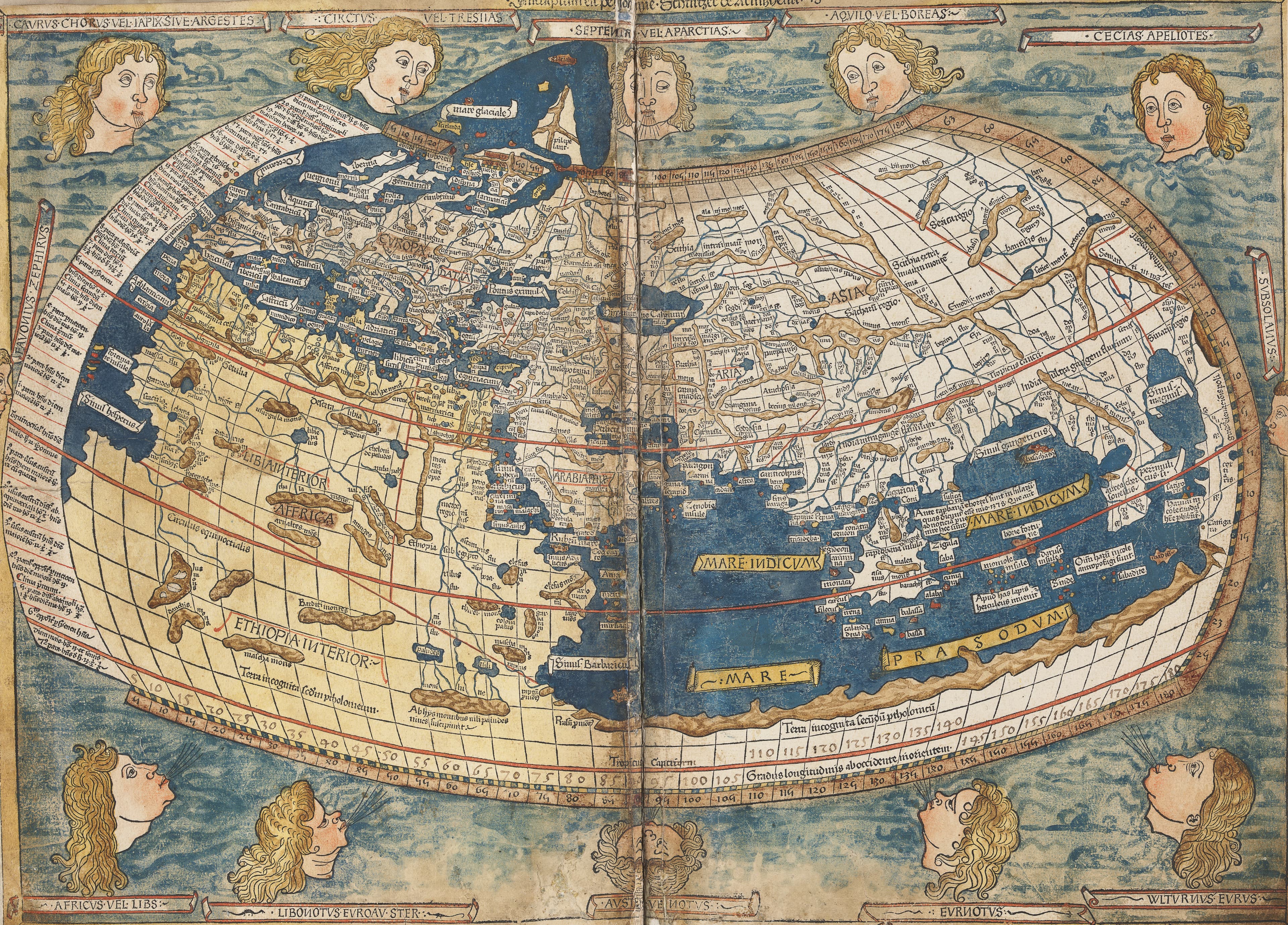
The Ulm Ptolemy World Map, 1482
Ptolemy's world, printed at Ulm in 1482.
- Map
- Cosmographia, Ulm 1482, world map
- Mapmaker
- Nicolaus Germanus; cut by Johann of Armsheim
- Date
- 1482
- Held by
- National Library of Sweden · via Wikimedia Commons
Format
The full-resolution scan, color-managed to the source — yours to print, study, and explore.
Size
$29.00
The story
This is the world map from the 1482 Ulm edition of Ptolemy's Cosmographia, now in the National Library of Sweden. The chain behind it is long: Ptolemy's second-century Geography, rediscovered in Greek by Maximus Planudes in the late thirteenth century, put into Latin by Jacobus Angelus in 1406, and emended by Nicolaus Germanus, whose maps Johann the blockcutter of Armsheim cut in wood. Twelve centuries of copying stand between Ptolemy and this sheet. It is the ancient world, handed to the first readers of print.
About this reproduction
- A faithful reproduction of a public-domain map held by National Library of Sweden · via Wikimedia Commons — the work is centuries out of copyright.
- Printed to order on 200gsm EMA matte art paper or 400gsm canvas; framed pieces sit behind acrylic.
- Color-managed to the source scan; we correct nothing and invent nothing.
- Ships in 5–10 business days, rolled in a heavy-wall tube (framed and linen-backed pieces ship flat-packed).
- If it arrives less than perfect, we reprint or refund — your choice.
Why our maps cost more than a poster: we print from the highest-resolution scans in existence, at sizes where the engraving itself becomes visible — the sea monsters, the tiny place-names, the burin lines — on matte paper that holds every line without glare.