Cartographic Wonders
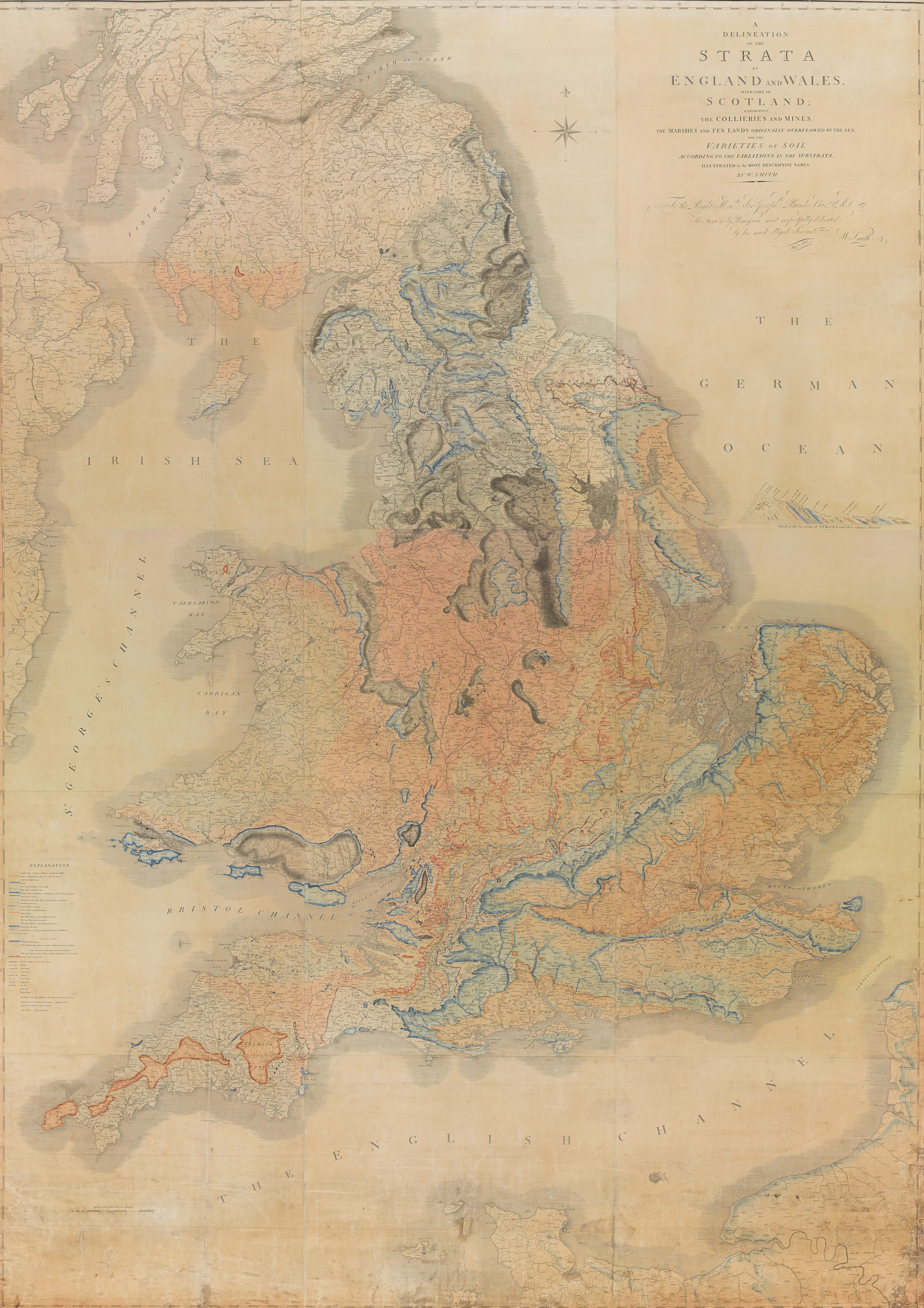
William Smith's Map of the Strata
The rocks beneath a whole country, in colour.
- Map
- A Delineation of the Strata of England and Wales with part of Scotland
- Mapmaker
- William Smith
- Date
- 1815
- Held by
- York Museums Trust · via Wikimedia Commons
Format
The full-resolution scan, color-managed to the source — yours to print, study, and explore.
Size
$29.00
The story
William Smith's delineation of the strata of England and Wales, with part of Scotland, published in August 1815, shows what lies under the ground: the collieries and mines, the marshes and fen lands that the sea once overflowed, and the soils as they change with the rock beneath them, named in the most descriptive terms Smith could find. Every band of colour stands for a layer of the earth. This copy belongs to York Museums Trust. It is a pioneering map, and the first sight many people had of the country's underside.
About this reproduction
- A faithful reproduction of a public-domain map held by York Museums Trust · via Wikimedia Commons — the work is centuries out of copyright.
- Printed to order on 200gsm EMA matte art paper or 400gsm canvas; framed pieces sit behind acrylic.
- Color-managed to the source scan; we correct nothing and invent nothing.
- Ships in 5–10 business days, rolled in a heavy-wall tube (framed and linen-backed pieces ship flat-packed).
- If it arrives less than perfect, we reprint or refund — your choice.
Why our maps cost more than a poster: we print from the highest-resolution scans in existence, at sizes where the engraving itself becomes visible — the sea monsters, the tiny place-names, the burin lines — on matte paper that holds every line without glare.