The Continents
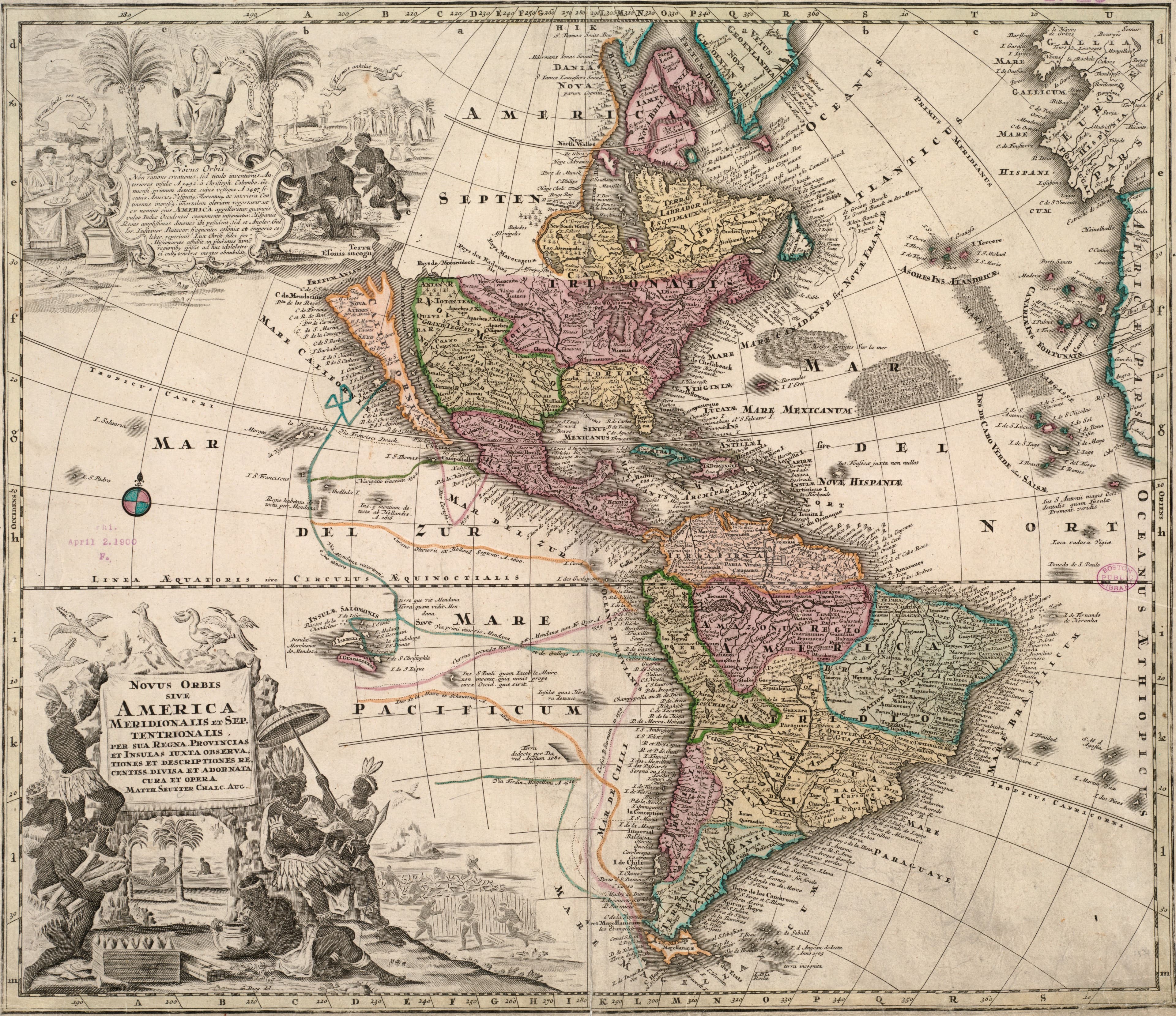
Seutter's New World
Both Americas, coloured by hand in Augsburg.
- Map
- Novus orbis sive America Meridionalis et Septentrionalis
- Mapmaker
- Matthäus Seutter
- Date
- c. 1731
- Held by
- Norman B. Leventhal Map & Education Center, Boston Public Library · via Digital Commonwealth
Format
The full-resolution scan, color-managed to the source — yours to print, study, and explore.
Size
$29.00
The story
Matthäus Seutter of Augsburg published this map of the New World, South and North America, by their kingdoms, provinces and islands, around 1731. It is coloured by hand, its relief drawn pictorially, and its longitudes counted from Ferro, the old prime meridian in the Canary Islands. Around the map, illustrations and text describe the Novus orbis for a German reader. The title promises the most recent observations and descriptions. Seutter's colour does the rest, picking out each kingdom and province so the two continents read at a glance across a room.
About this reproduction
- A faithful reproduction of a public-domain map held by Norman B. Leventhal Map & Education Center, Boston Public Library · via Digital Commonwealth — the work is centuries out of copyright.
- Printed to order on 200gsm EMA matte art paper or 400gsm canvas; framed pieces sit behind acrylic.
- Color-managed to the source scan; we correct nothing and invent nothing.
- Ships in 5–10 business days, rolled in a heavy-wall tube (framed and linen-backed pieces ship flat-packed).
- If it arrives less than perfect, we reprint or refund — your choice.
Why our maps cost more than a poster: we print from the highest-resolution scans in existence, at sizes where the engraving itself becomes visible — the sea monsters, the tiny place-names, the burin lines — on matte paper that holds every line without glare.