The Continents
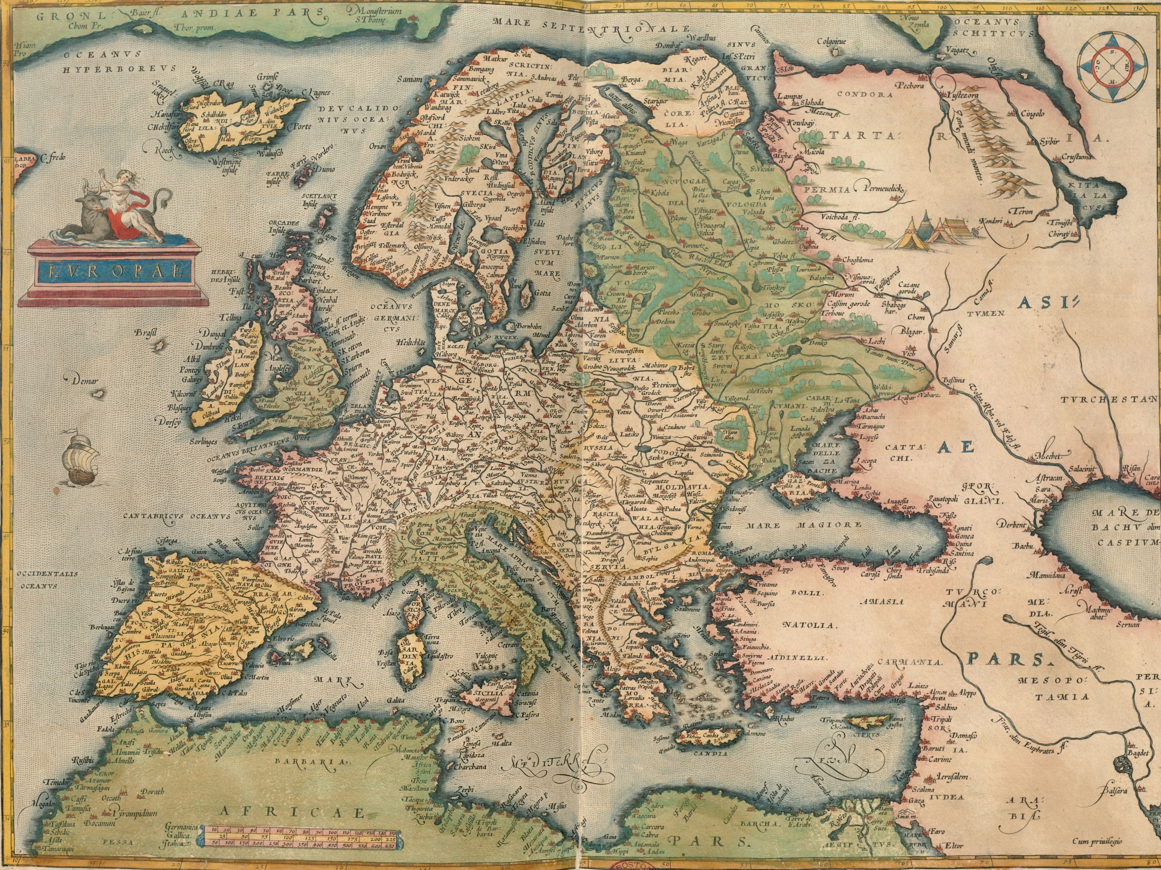
Ortelius's Europe, 1570
Shakespeare's Europe, from the 1570 Theatrum.
- Map
- Europae
- Mapmaker
- Abraham Ortelius
- Date
- 1570
- Held by
- Norman B. Leventhal Map & Education Center, Boston Public Library · via Digital Commonwealth
Format
The full-resolution scan, color-managed to the source — yours to print, study, and explore.
Size
$29.00
The story
Abraham Ortelius, a contemporary of William Shakespeare, made this map of Europe, the Mediterranean, North Africa and western Asia for the 1570 Antwerp edition of his Theatrum orbis terrarum. These were the regions an educated Renaissance reader knew by trade and by reputation, and the ones Shakespeare's characters travel through, bringing home reports of unfamiliar places that held both allure and threat for an audience. The Latin text on the back asks where the name Europe came from. Read it with the plays in mind, and the stage directions start to look like a route.
About this reproduction
- A faithful reproduction of a public-domain map held by Norman B. Leventhal Map & Education Center, Boston Public Library · via Digital Commonwealth — the work is centuries out of copyright.
- Printed to order on 200gsm EMA matte art paper or 400gsm canvas; framed pieces sit behind acrylic.
- Color-managed to the source scan; we correct nothing and invent nothing.
- Ships in 5–10 business days, rolled in a heavy-wall tube (framed and linen-backed pieces ship flat-packed).
- If it arrives less than perfect, we reprint or refund — your choice.
Why our maps cost more than a poster: we print from the highest-resolution scans in existence, at sizes where the engraving itself becomes visible — the sea monsters, the tiny place-names, the burin lines — on matte paper that holds every line without glare.