The Continents
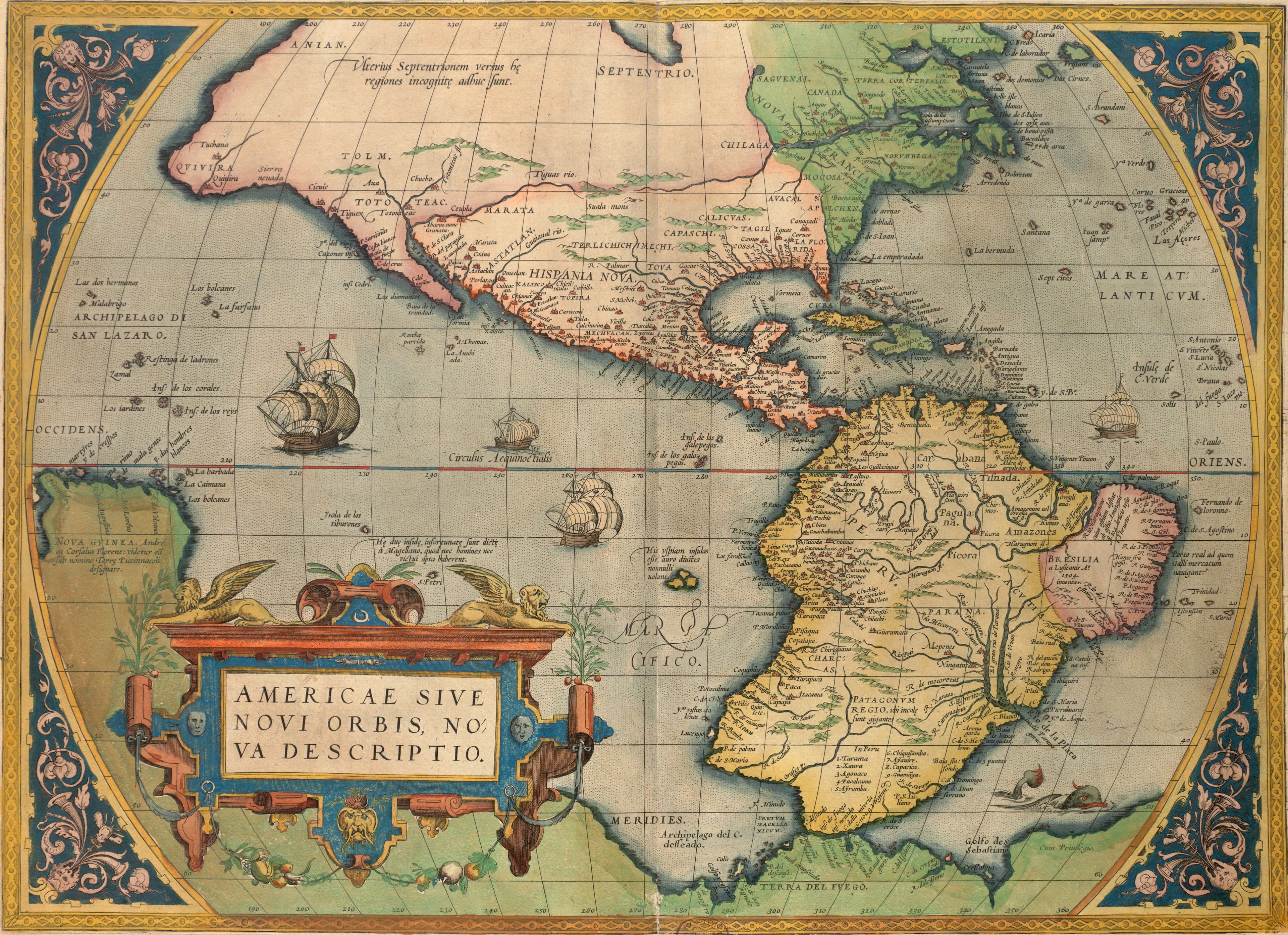
Ortelius's America, 1570
The New World, from the 1570 Theatrum.
- Map
- Americae sive novi orbis, nova descriptio
- Mapmaker
- Abraham Ortelius
- Date
- 1570
- Held by
- Norman B. Leventhal Map & Education Center, Boston Public Library · via Digital Commonwealth
Format
The full-resolution scan, color-managed to the source — yours to print, study, and explore.
Size
$29.00
The story
This map of America, the new world, comes from the 1570 Antwerp edition of Abraham Ortelius's Theatrum orbis terrarum, printed by Gillis Coppens van Diest under royal privilege. Ortelius gave it decorative corners, a title cartouche, and oceans of fish and ships. The shape of the two continents is what a scholar in Antwerp could assemble from other people's voyages, and North America swells far to the west of where it belongs. Latin text on the back describes the lands. Here is the New World seventy-eight years after Columbus, still being argued into shape.
About this reproduction
- A faithful reproduction of a public-domain map held by Norman B. Leventhal Map & Education Center, Boston Public Library · via Digital Commonwealth — the work is centuries out of copyright.
- Printed to order on 200gsm EMA matte art paper or 400gsm canvas; framed pieces sit behind acrylic.
- Color-managed to the source scan; we correct nothing and invent nothing.
- Ships in 5–10 business days, rolled in a heavy-wall tube (framed and linen-backed pieces ship flat-packed).
- If it arrives less than perfect, we reprint or refund — your choice.
Why our maps cost more than a poster: we print from the highest-resolution scans in existence, at sizes where the engraving itself becomes visible — the sea monsters, the tiny place-names, the burin lines — on matte paper that holds every line without glare.