Mappæ Mundi
The First Printed World Map, Paris Edition
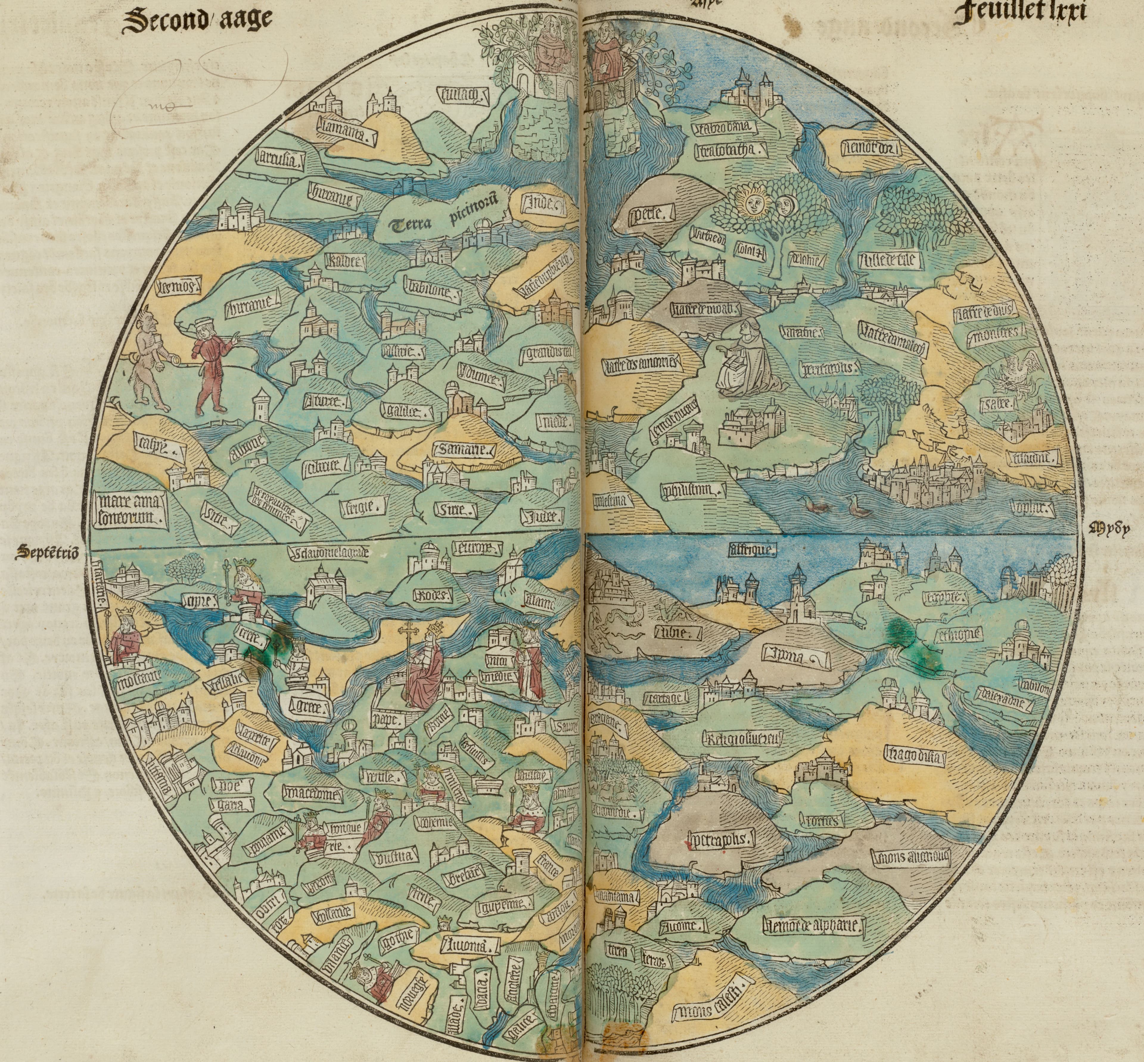
The first printed map of the world, with east at the top.
- Map
- Circular world map, from La mer des hystoires
- Mapmaker
- Pierre Le Rouge
- Date
- 1488 to 1489
- Held by
- Boston Public Library, Rare Books Department · via Digital Commonwealth
Format
The full-resolution scan, color-managed to the source — yours to print, study, and explore.
Size
$29.00
The story
The circular world map that first appeared in the 1475 Latin Rudimentum Novitiorum is counted as the first printed map of the world, and this is its French descendant, on leaf 71 of La mer des hystoires, printed in Paris by Pierre Le Rouge in 1488. It follows the medieval mappa mundi: a circle with east at the top, divided into three continents. But it carries more than a hundred place names set in fair relation to each other, and Judea and Palestine sit plainly at its centre. The diagram of faith is turning, slowly, into a map.
About this reproduction
- A faithful reproduction of a public-domain map held by Boston Public Library, Rare Books Department · via Digital Commonwealth — the work is centuries out of copyright.
- Printed to order on 200gsm EMA matte art paper or 400gsm canvas; framed pieces sit behind acrylic.
- Color-managed to the source scan; we correct nothing and invent nothing.
- Ships in 5–10 business days, rolled in a heavy-wall tube (framed and linen-backed pieces ship flat-packed).
- If it arrives less than perfect, we reprint or refund — your choice.
Why our maps cost more than a poster: we print from the highest-resolution scans in existence, at sizes where the engraving itself becomes visible — the sea monsters, the tiny place-names, the burin lines — on matte paper that holds every line without glare.