Cartographic Wonders
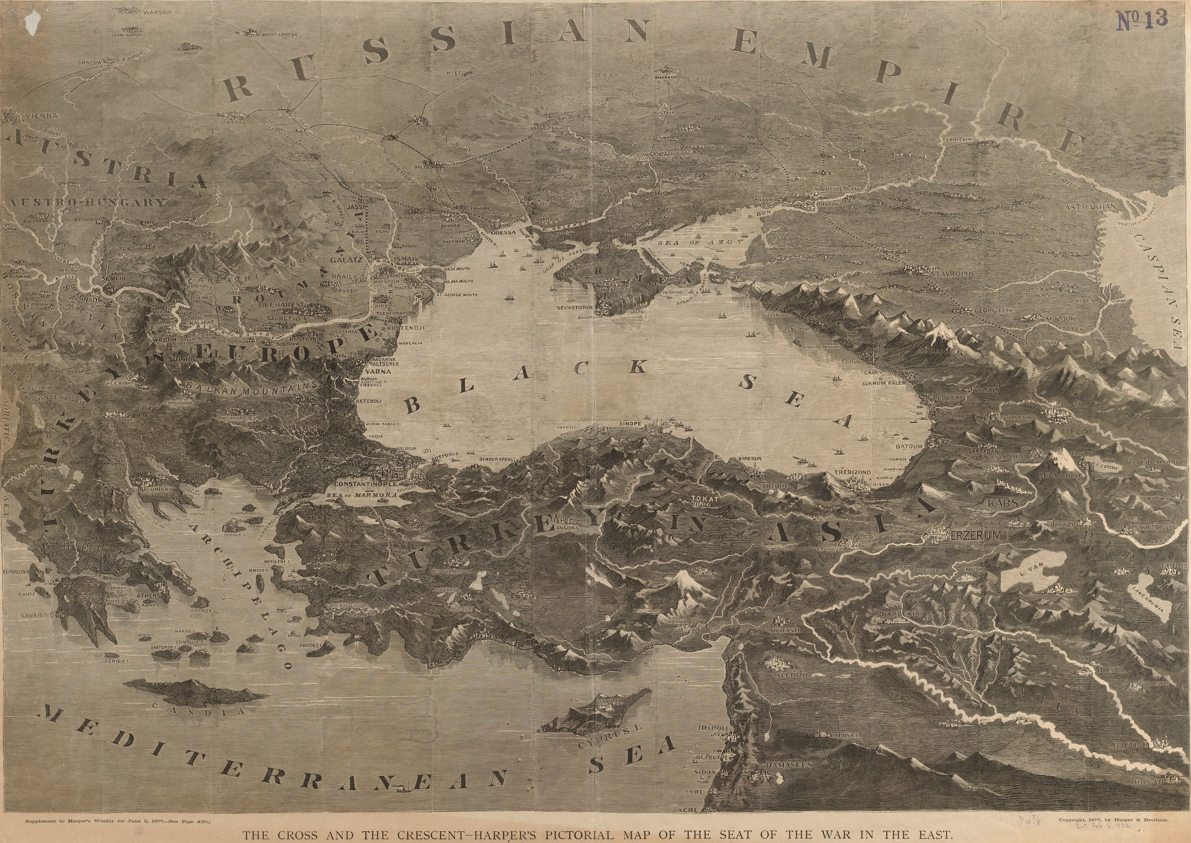
Harper's Cross and Crescent
The Russo-Turkish war, for an American breakfast table.
- Map
- The cross and the crescent: Harper's pictorial map of the seat of the war in the east
- Mapmaker
- Harper & Brothers
- Date
- 1877
- Held by
- Norman B. Leventhal Map & Education Center, Boston Public Library · via Digital Commonwealth
Format
The full-resolution scan, color-managed to the source — yours to print, study, and explore.
Size
$29.00
The story
Harper's Weekly gave its readers this pictorial map of the seat of the war in the east as a supplement in June 1877, with the cross and the crescent in its title. The relief is shown as landforms, so the reader looks across mountains and straits toward the fighting. An American family could follow a war on the far side of the Atlantic with this sheet open on the table. It is the same war Fred Rose drew as an octopus in London that year, which is also in this collection, seen here as geography instead of caricature.
About this reproduction
- A faithful reproduction of a public-domain map held by Norman B. Leventhal Map & Education Center, Boston Public Library · via Digital Commonwealth — the work is centuries out of copyright.
- Printed to order on 200gsm EMA matte art paper or 400gsm canvas; framed pieces sit behind acrylic.
- Color-managed to the source scan; we correct nothing and invent nothing.
- Ships in 5–10 business days, rolled in a heavy-wall tube (framed and linen-backed pieces ship flat-packed).
- If it arrives less than perfect, we reprint or refund — your choice.
Why our maps cost more than a poster: we print from the highest-resolution scans in existence, at sizes where the engraving itself becomes visible — the sea monsters, the tiny place-names, the burin lines — on matte paper that holds every line without glare.