Cartographic Wonders
Blaeu's Bermuda
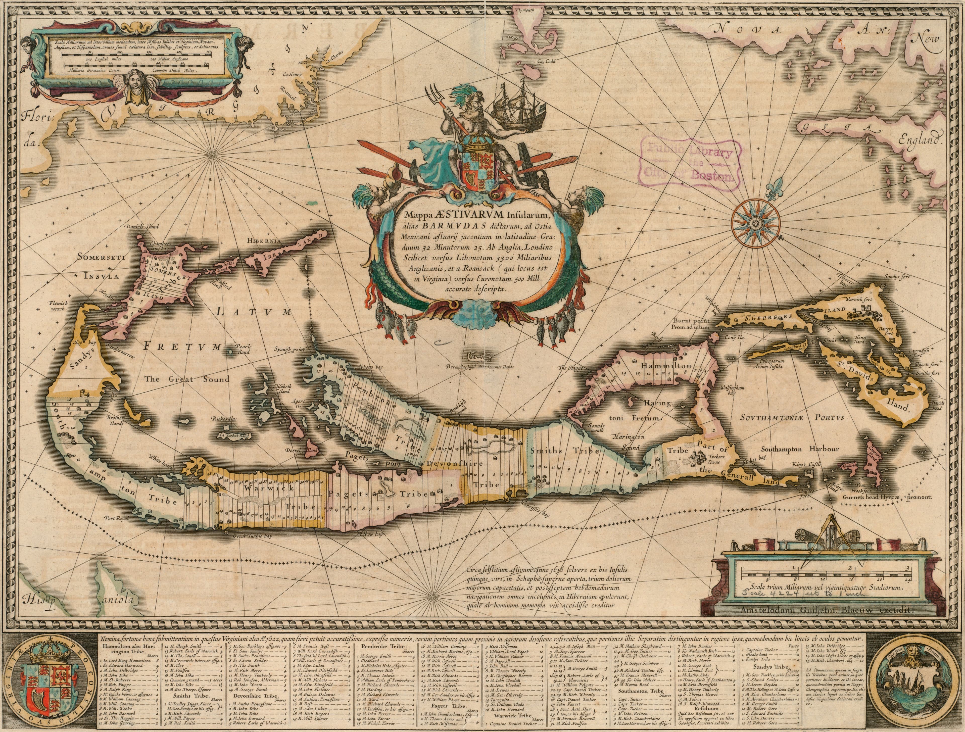
The Summer Islands, with every landowner named.
- Map
- Mappa aestivarum insularum, alias Barmudas dictarum
- Mapmaker
- Willem Janszoon Blaeu
- Date
- c. 1662
- Held by
- Norman B. Leventhal Map & Education Center, Boston Public Library · via Digital Commonwealth
Format
The full-resolution scan, color-managed to the source — yours to print, study, and explore.
Size
$29.00
The story
The Summer Islands, otherwise called the Bermudas, the title says, lying in 32 degrees 25 minutes, 3,300 English miles from London and 500 from Roanoke in Virginia. Blaeu's map turns north toward the upper right, so the islands lie across the sheet like a hook. Then look closer: the land is divided into its holdings, and the names of the landowners are written into them. Latin text fills pages 103 and 104 on the back. A whole colony, small enough that a mapmaker in Amsterdam could name every owner in it.
About this reproduction
- A faithful reproduction of a public-domain map held by Norman B. Leventhal Map & Education Center, Boston Public Library · via Digital Commonwealth — the work is centuries out of copyright.
- Printed to order on 200gsm EMA matte art paper or 400gsm canvas; framed pieces sit behind acrylic.
- Color-managed to the source scan; we correct nothing and invent nothing.
- Ships in 5–10 business days, rolled in a heavy-wall tube (framed and linen-backed pieces ship flat-packed).
- If it arrives less than perfect, we reprint or refund — your choice.
Why our maps cost more than a poster: we print from the highest-resolution scans in existence, at sizes where the engraving itself becomes visible — the sea monsters, the tiny place-names, the burin lines — on matte paper that holds every line without glare.